Badlands National Park, South Dakota
Approaching
the North Dakota Badlands from the south, the first thing you notice is a white
band or wall off to the north, rising above the prairie. In the bright mid-day sunlight, it’s hard to
discern any texture to the band other than some higher peaks here and there. As you get closer, the texture of the wall
becomes more three-dimensional, with what looks like a continuous line of vertical
folds and deep gullies along the exposed edge, and the true light grey color of
the rock becomes apparent. Finally, as
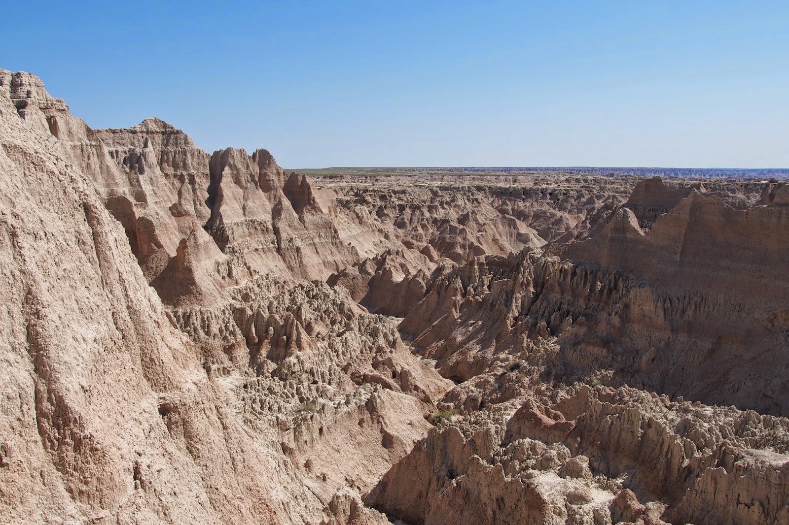
you enter the park and actually approach this 300-foot tall wall, the edge
breaks into a jumbled mass of fins and towers of what looks like white rock
with several horizontal, pale pink bands. And, as you approach the rock close up on
foot, you realize that it’s not what I’d call true rock at all, it’s more what
I’d call mud stone — harder than mud, but softer than rock. It almost crumbles in your hand. Even to the untrained eye, it’s obvious that
this is a sedimentary deposit — after all, this whole area was once the bed of
an ancient sea, and over the course of several million years, tons and tons of
silt, plus the remains of untold billions of tiny plankton settled to the
bottom. Later, as the continents shifted
and collided and the ancestral Rockies pushed their way skyward, this sea floor
was raised. Then, the forces of nature
eroded the mountains and the outwash flowed eastward, covering the ersatz
seafloor, which was now a lush tropical forest teeming with early life
forms. Volcanos erupted to the west, and
clouds of ash drifted eastward, falling in layer after layer. Occasionally the eruptions were gigantic,
dropping not centimeters of ash or inches of ash, but feet of ash which buried
much of the vegetation and the creatures of this land. And this continued on and on over more
millions of years, along with massive floods bringing layer after of silt. Slowly this all built up to hundreds, even
thousands of feet thick, forming the vast steppes that stretch across the
middle of the North American continent, from the Gulf of Mexico to the Arctic
Ocean.
But the
forces of nature continued, and as the rains fell and the run-off gathered into
rivulets, streams and rivers, once more the power of erosion began cutting
gullies, then canyons into the land. The
surface of the land was soft layers of sedimentary soil and rock, and the
canyons evolved into broad valleys. This
process continues today as the rain that falls on the prairie seeks the White
River, which now flows eastward through an ever-widening valley. This jumble of gullies and mini-canyons we
call the Badlands of South Dakota is merely today’s edge of the valley. As it slowly erodes further to the north, it
leaves behind a few outcrops of harder rock that form the towers and spires
that bring today’s throngs of gawking tourists.
Into
this mixed bag of grassland prairie and twisted gullies we came a-hiking on a
clear spring day. We did a mixed bag of
short strolls along tidy boardwalks designed to funnel visitors on certain
paths liberally spattered with “Beware of Rattlesnakes” signs, to one
four-and-a-half mile hike that began with a 200+ foot climb up from the valley
floor through one of the aforesaid mini-canyons to the prairie above, then
along a winding loop across the treeless grass flats, and finally back down the
steep trail to the starting point. In
between, we drove several miles along the Badlands Loop road, pausing at
several overlooks to gaze out into the valley below.
Finally,
it was back to the campsite and a well-deserved, but not even vaguely
resembling warm, shower and a so-so burger at the park’s Cedar Pass Lodge.
Tomorrow
we move on to the Devil’s Tower.
 |
| Approaching the Badlands from the south. |
 |
| Looking down one of the mini-canyons. |
No comments:
Post a Comment